RustGIS brings geospatial analysis to Grok Bot via built-in MCP/CLI
RustGIS is a free open-source GIS written in pure Rust with built-in MCP/CLI, and a Grok Bot template shows it buffering live wildfire perimeters and overlaying counties to map 40 exposed Pacific Northwest counties.

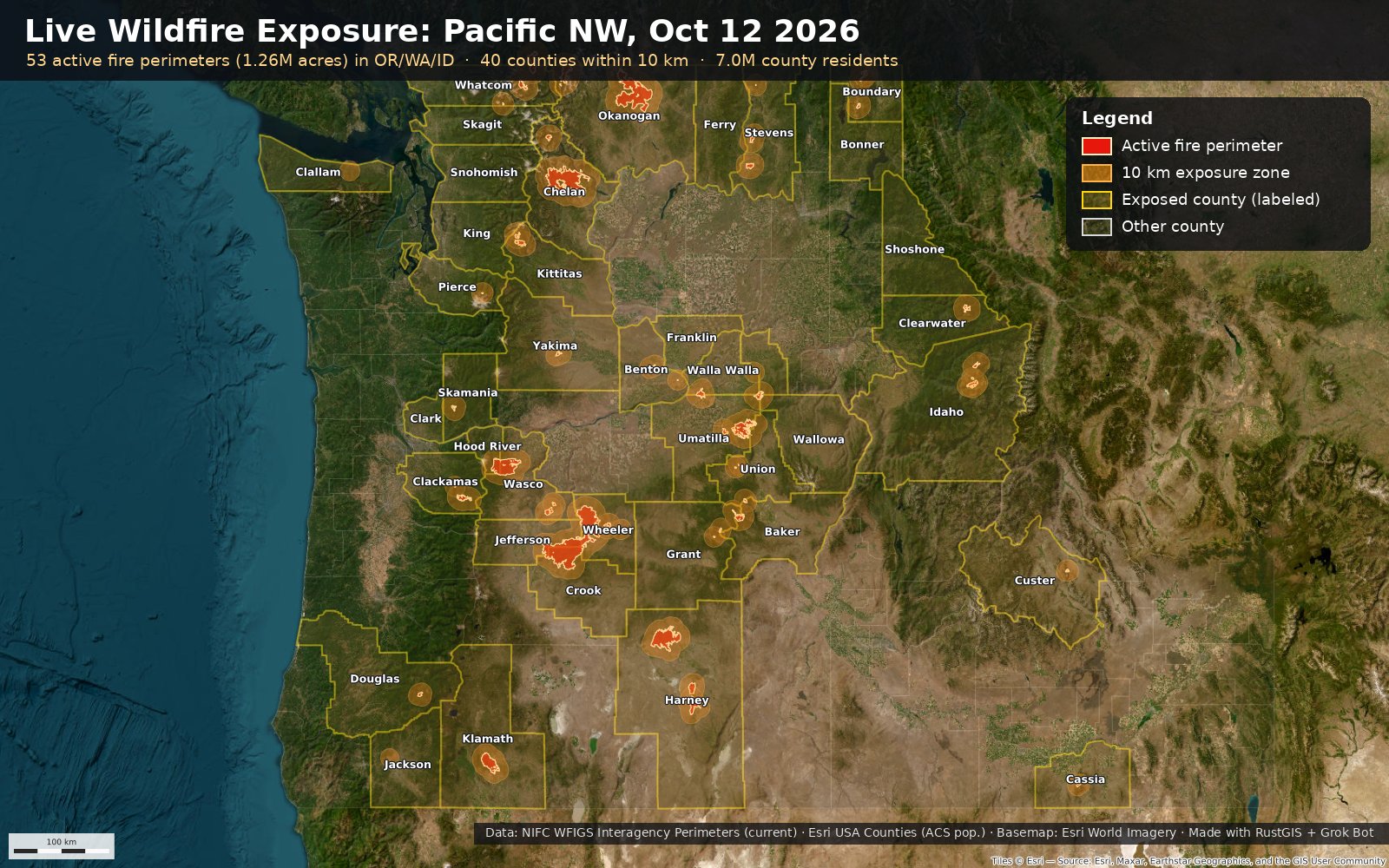
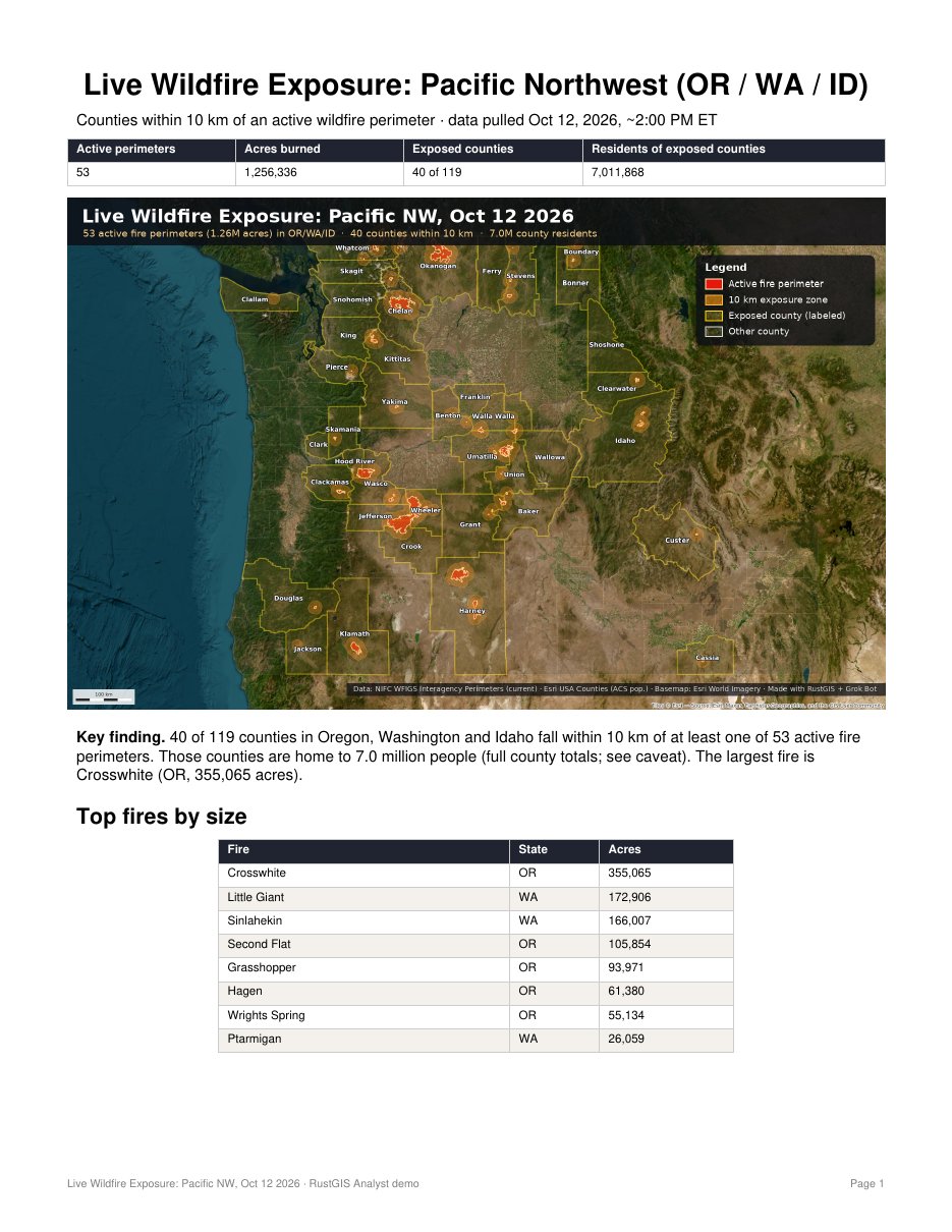
RustGIS is a fast, free and open-source GIS in pure Rust for mapping, analyzing and sharing geospatial data. Its a really good fit for running in agent bots, its fast and well organized with builtin mcp/cli. https://rustgis.app/ Here's a @grok @bot template to install it in GrokBot. example: "I asked my Grok Bot to pull today's live wildfire perimeters from a public ArcGIS service and check which counties are exposed. In seconds RustGIS buffered them by 10 km, overlaid counties, and made the map + report: 40 Pacific NW counties, 7.0M residents."