GeoLibre v3.2.0: point cloud annotation and MCP tools
The open-source GIS platform GeoLibre updated to 3.2.0, adding on-map point cloud annotation, private S3 bucket access, desktop keychain storage, and annotation tools exposed as MCP tools for AI agents.

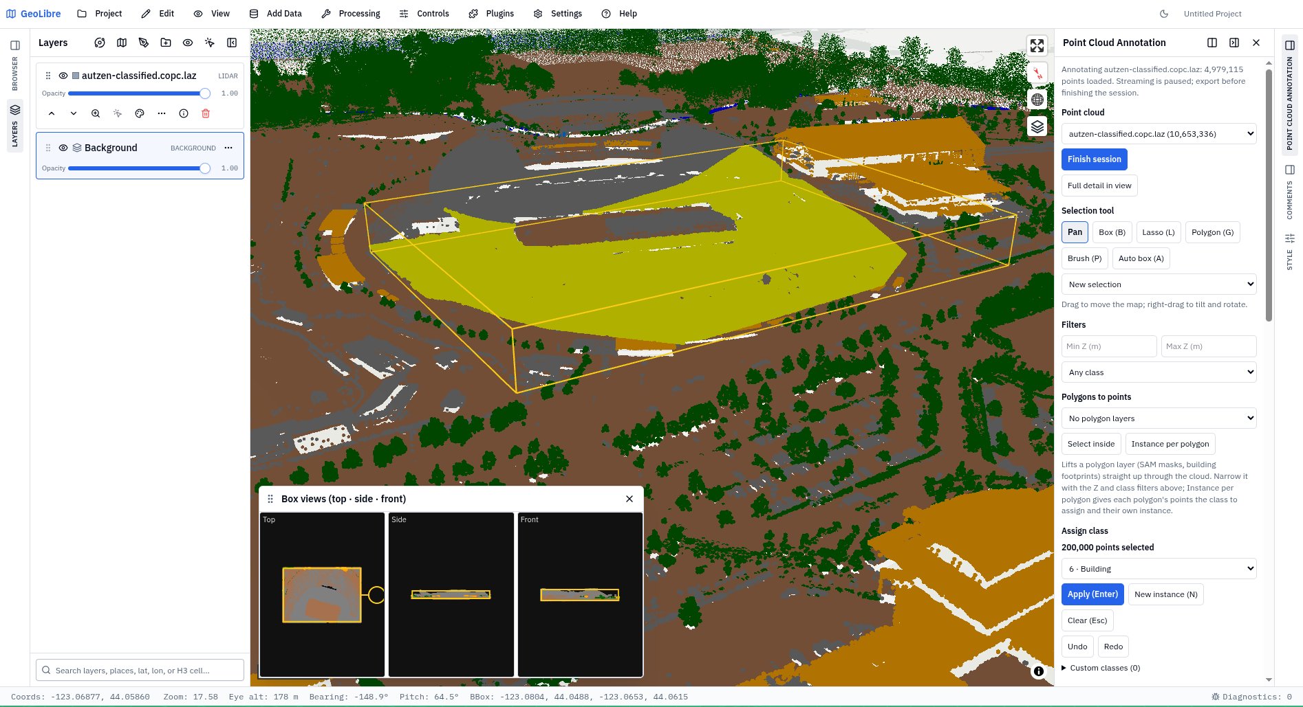
GeoLibre v3.2.0 is here! GeoLibre is a free and open-source, lightweight, cloud-native GIS platform for visualizing, exploring, and analyzing geospatial data. It runs everywhere you do, in the web browser, on the desktop, on mobile, and inside Jupyter notebooks, all while keeping your data local and private. This release brings point cloud annotation right on the map, secure access to private S3 buckets, and the public GIS portals of every US state in a single menu. What's new in v3.2.0 - Point Cloud Annotation: label LiDAR points with brushes and polygons, use ASPRS or custom classes, draw oriented 3D boxes, pre-label with Whitebox classifiers in the browser, and export labelled LAS/LAZ, NumPy, or GeoJSON. - Point cloud labelling from Python and AI agents: the same annotation tools are available in Jupyter notebooks and as MCP tools. - Private S3 buckets: connect with access keys, named profiles, SSO sign-in, or IAM roles, and browse buckets in the new S3 Browser. - Secure credentials on desktop: API keys and tokens are stored in the macOS Keychain, Windows Credential Manager, or Linux Secret Service. - US GIS portals in one menu: 24 federal agencies, all 50 states and DC, about 150 cities and counties, plus HUB Ocean's Ocean Data Platform. - WMS in any projection: choose a layer's CRS, with projected-only servers reprojected on the fly, and WFS servers load through GML. - Reusable layer styles: export every layer's style to one file and apply it to matching layers by name, or automatically as layers are added. Try it out - Launch GeoLibre Web: https://web.geolibre.app - GitHub: https://github.com/opengeos/GeoLibre - Documentation: https://geolibre.app - Release notes: https://github.com/opengeos/GeoLibre/releases/tag/v3.2.0 #GIS #GeospatialData #OpenSource #LiDAR #PointCloud #RemoteSensing #MapLibre #Python